


Por favor, use este identificador para citar o enlazar este ítem:
http://hdl.handle.net/20.500.11765/11889
Sea breeze convergence and convective cloud frequencies from AVHRR data over the Isle of Mallorca
Registro completo de metadatos
| Campo DC | Valor | Lengua/Idioma |
|---|---|---|
| dc.contributor.author | Azorín Molina, César | es_ES |
| dc.contributor.author | Guijarro Pastor, José Antonio | es_ES |
| dc.contributor.author | Baena Calatrava, Rafael | es_ES |
| dc.contributor.author | Jansà Clar, Agustí | es_ES |
| dc.date.accessioned | 2020-05-22T10:17:36Z | - |
| dc.date.available | 2020-05-22T10:17:36Z | - |
| dc.date.issued | 2007 | - |
| dc.identifier.citation | VII Annual Meeting of the European Meteorological Society (2007) | es_ES |
| dc.identifier.uri | http://hdl.handle.net/20.500.11765/11889 | - |
| dc.description | Póster presentado en: 7th Annual Meeting of the European Meteorological Society/8th European Conference on Applications of Meteorology celebrado en San Lorenzo del Escorial, del 1 al 5 de octubre de 2007. | es_ES |
| dc.description.abstract | The short-term forecast of the timing, location and intensity of sea breeze convection is currently one of the most difficult atmospheric phenomena, as forecasting tools available are not enough. The line of Cu clouds associated with low level sea breeze convergence and sea breeze complex interactions with features of coastline, small-scale terrain and large-scale synoptic flows is the main feature of this β-mesoscale circulation over the Isle of Mallorca. The boundary layer convergence zones developed by sea breezes can trigger scattered local heavy showers and thunderstorms under conditionally unstable atmosphere, which sometimes can be extraordinarily severe, producing hailstone and gusty winds. AVHRR data from the NOAA-17 (0900-1200 UTC) and NOAA16 (1200-1500 UTC) satellites were collected during 8-month study period (March-October 2004) for computing high-resolution (1.1 km) convective cloud masks making use of a new APOLLO cloud detection algorithm. A non-eulerian numerical model is used in order to simulate the diurnal evolution of mesoscale sea breeze field and calculate wind convergence values for a high resolution grid-point basis covering the centre of the Isle of Mallorca and surrounding Mediterranean sea. This study attempts to statistically verify the impact of low-level convergence of sea breezes on convective cloud development. The two-dimensional numerical model is capable of forecasting a reasonably accurate location of most prominent convective zones mapped by the cloud detection algorithm. Three case studies on influences of different intensities of low-level sea breeze convergence upon convective development were simulated: (1) September 17th, 2004 represents an episode of weak sea breeze convergence; (2) June 17th, 2004 corresponds to a light to moderate sea breeze convergence; and (3) July 27th, 2004 illustrates a strong sea breeze convergence. | es_ES |
| dc.description.sponsorship | The study was supported by Spain’s Education and Science Ministry (MEC) project IPIBEX (CGL2005-07664-C02-01). | es_ES |
| dc.language.iso | eng | es_ES |
| dc.publisher | Instituto Nacional de Meteorología | es_ES |
| dc.rights | Licencia CC: Reconocimiento–NoComercial–SinObraDerivada CC BY-NC-ND | es_ES |
| dc.subject | Sea breeze convergence | es_ES |
| dc.subject | Atmospheric phenomena | es_ES |
| dc.subject | Numerical model | es_ES |
| dc.title | Sea breeze convergence and convective cloud frequencies from AVHRR data over the Isle of Mallorca | es_ES |
| dc.type | info:eu-repo/semantics/conferenceObject | es_ES |
| dc.relation.publisherversion | https://dx.doi.org/10.13140/2.1.3184.4160 | es_ES |
| dc.rights.accessRights | info:eu-repo/semantics/openAccess | es_ES |
| Colecciones: | EMS Annual Meeting and European Conference on Applications of Meteorology - Póster | |
Ficheros en este ítem:
| Fichero | Descripción | Tamaño | Formato | ||
|---|---|---|---|---|---|
| 2007_Azorin_Molina_et... | 295,43 kB | Adobe PDF | 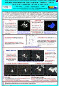 Visualizar/Abrir |


Los ítems de Arcimis están protegidos por una Licencia Creative Commons, salvo que se indique lo contrario.