Por favor, use este identificador para citar o enlazar este ítem:
http://hdl.handle.net/20.500.11765/11977
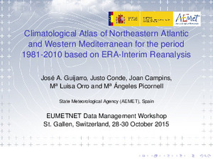
Climatological Atlas of Northeastern Atlantic and Western Mediterranean for the period 1981-2010 based on ERA-Interim Reanalysis
| Título : | Climatological Atlas of Northeastern Atlantic and Western Mediterranean for the period 1981-2010 based on ERA-Interim Reanalysis |
| Autor : | Guijarro Pastor, José Antonio


|
| Palabras clave : | Maritime climate information; Wind speed; Sea surface temperature |
| Fecha de publicación : | oct-2015 |
| Editor: | Agencia Estatal de Meteorología |
| Citación : | 10th EUMETNET Data Management Workshop (2015) |
| Resumen : | Maritime climate information is very important for the long term planning of a number of activities as maritime transportation of goods and people, fishing, touristic cruises, etc. In order to update these information for the last thirty year period 1981-2010, data of wave height and period, wind speed, wind direction and sea surface temperature were obtained from the ERA-Interim reanalysis with a resolution of 1° for a large maritime area (35°W to 12°E and 0 to 52°N) framing zones for which the Spanish Meteorological Agency (AEMET) issues predictions of maritime meteorology. The reanalysis data were downloaded for the period 1981-2013, in order to compare wind and wave conditions with those recorded by open water buoys of the Spanish Agency Puertos del Estado during the five years 2009-2013. A good overall agreement was found between both data-sets, with some discrepancies that can be explained by the effect of the neighboring coastal topography. Therefore, the climatology provided by this atlas must be taken with caution in coastal areas. The atlas is composed of monthly and annual maps of: · Percentiles 50, 95 and 100 of significant wave height, wind speed, mean period and sea surface temperature · Wind roses · Frequencies of significant wave height over 2.5, 6 y 9 m · Frequencies of wind speed over 11.1, 17.3 y 24.4 m/s A companion program written in R allows the interactive generation of climate descriptions for any 1x1° maritime square within the studied area. |
| Descripción : | Presentación realizada en: 10th EUMETNET Data Management Workshop celebrado en St. Gallen, Suiza, del 28 al 30 de octubre de 2015. |
| URI : | http://hdl.handle.net/20.500.11765/11977 |
| Colecciones: | Otras presentaciones-congresos |
Ficheros en este ítem:
| Fichero | Descripción | Tamaño | Formato | ||
|---|---|---|---|---|---|
| 23_Guijarro_Slides_we... | 1,23 MB | Adobe PDF |  Visualizar/Abrir | ||
| Guijarro_Abstract1.pdf | 38,53 kB | Adobe PDF |  Visualizar/Abrir |
Los ítems de Arcimis están protegidos por una Licencia Creative Commons, salvo que se indique lo contrario.


