Por favor, use este identificador para citar o enlazar este ítem:
http://hdl.handle.net/20.500.11765/1342
Development and analysis of a 50-year high-resolution daily gridded precipitation dataset over Spain (Spain02)
Registro completo de metadatos
| Campo DC | Valor | Lengua/Idioma |
|---|---|---|
| dc.contributor.author | Herrera García, Sixto | es_ES |
| dc.contributor.author | Gutiérrez Llorente, José Manuel | es_ES |
| dc.contributor.author | Ancell, Rafael | es_ES |
| dc.contributor.author | Pons Reynés, María Rosa | es_ES |
| dc.contributor.author | Frías Domínguez, María Dolores | es_ES |
| dc.contributor.author | Fernández Fernández, Jesús | es_ES |
| dc.date.accessioned | 2016-03-17T14:50:16Z | - |
| dc.date.available | 2016-03-17T14:50:16Z | - |
| dc.date.issued | 2010 | - |
| dc.identifier.citation | International Journal of Climatology. 2012, 32 (1), p. 74-85 | es_ES |
| dc.identifier.issn | 0899-8418 | - |
| dc.identifier.issn | 1097-0088 | - |
| dc.identifier.uri | http://hdl.handle.net/20.500.11765/1342 | - |
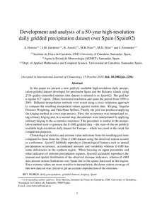
| dc.description.abstract | In this paper, we present a new publicly available high-resolution daily precipitation gridded dataset developed for peninsular Spain and the Balearic islands using 2756 quality-controlled stations (this dataset is referred to as Spain02 ). The grid has a regular 0.2° (approx. 20 km) horizontal resolution and spans the period from 1950 to 2003. Different interpolation methods were tested using a cross-validation approach to compare the resulting interpolated values against station data: kriging, angular distance weighting, and thin plane splines. Finally, the grid was produced applying the kriging method in a two-step process. First, the occurrence was interpolated using a binary kriging and, in a second step, the amounts were interpolated by applying ordinary kriging to the occurrence outcomes. This procedure is similar to the interpolation method used to generate the E-OBS gridded data – the state-of-the-art publicly available high-resolution daily dataset for Europe – which was used in this study for comparison purposes. Climatological statistics and extreme value indicators from the resulting grid were compared to those from the 25 km E-OBS dataset using the observed station records as a reference. Spain02 faithfully reproduces climatological features such as annual precipitation occurrence, accumulated amounts and variability, whereas E-OBS has some deficiencies in the southern region. When focusing on upper percentiles and other indicators of extreme precipitation regimes, Spain02 accurately reproduces the amount and spatial distribution of the observed extreme indicators, whereas E-OBS data present serious limitations over Spain due to the sparse data used in this region. As extreme values are more sensitive to interpolation, the dense station coverage of this new data set was crucial to get an accurate reproduction of the extremes. | es_ES |
| dc.format | application/pdf | - |
| dc.language.iso | eng | es_ES |
| dc.publisher | Royal Meteorological Society | es_ES |
| dc.publisher | Wiley | es_ES |
| dc.subject | Gridded dataset | - |
| dc.subject | Daily precipitation | - |
| dc.subject | Precipitación diaria | es_ES |
| dc.subject | Datos de precipitación | es_ES |
| dc.subject | Series de precipitación | es_ES |
| dc.subject | Kriging | es_ES |
| dc.title | Development and analysis of a 50-year high-resolution daily gridded precipitation dataset over Spain (Spain02) | es_ES |
| dc.type | info:eu-repo/semantics/article | es_ES |
| dc.relation.publisherversion | https://dx.doi.org/10.1002/joc.2256 | es_ES |
| dc.rights.accessRights | info:eu-repo/semantics/openAccess | es_ES |
| Colecciones: | Artículos científicos 2010-2014 | |
Ficheros en este ítem:
| Fichero | Descripción | Tamaño | Formato | ||
|---|---|---|---|---|---|
| 2010_Herrera_IJC_Spai... | 5,96 MB | Adobe PDF |  Visualizar/Abrir |
Los ítems de Arcimis están protegidos por una Licencia Creative Commons, salvo que se indique lo contrario.


