Por favor, use este identificador para citar o enlazar este ítem:
http://hdl.handle.net/20.500.11765/7371
Comparison of ground based global radiation measurements from AEMET radiation network with SIS (Surface Incoming Shortwave Radiation) from Climate Monitoring-SAF
| Título : | Comparison of ground based global radiation measurements from AEMET radiation network with SIS (Surface Incoming Shortwave Radiation) from Climate Monitoring-SAF |
| Autor : | Sancho Ávila, Juan Manuel


|
| Palabras clave : | Daily global radiation; Surface Incoming Shortwave Radiation; Solar radiation; Radiometric stations |
| Fecha de publicación : | 2010 |
| Citación : | EUMETSAT Meteorological Satellite Conference (2010) |
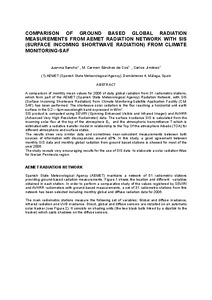
| Resumen : | A comparison of monthly mean values for 2006 of daily global radiation from 31 radiometric stations, which form part of the AEMET (Spanish State Meteorological Agency) Radiation Network, with SIS (Surface Incoming Shortwave Radiation) from Climate Monitoring-Satellite Application Facility (CMSAF) has been performed. The shortwave solar radiation is the flux reaching a horizontal unit earth surface in the 0.2 – 4µm wavelength band expressed in W/m2 . SIS product is computed using SEVIRI (Spinning Enhanced Visible and Infrared Imager) and AVHRR (Advanced Very High Resolution Radiometer) data. The surface irradiance SIS is calculated from the incoming solar flux at the top of the atmosphere E0, and the atmospheric transmittance T which is estimated with a radiative transfer model in relationship to the Top Of the atmosphere Albedo (TOA) for different atmospheric and surface states. The results show very similar data and sometimes near-coincident measurements between both sources of information with discrepancies around ±5%. In this study, a good agreement between monthly SIS data and monthly global radiation from ground based stations is showed for most of the year 2006. The study reveals very encouraging results for the use of SIS data to elaborate a solar radiation Atlas for Iberian Peninsula region. |
| Descripción : | Ponencia presentada en: 2010 EUMETSAT Meteorological Satellite Conference celebrada del 20-24 de septiembre de 2010 en Córdoba. |
| URI : | http://hdl.handle.net/20.500.11765/7371 |
| Colecciones: | Otras actas-congresos |
Ficheros en este ítem:
| Fichero | Descripción | Tamaño | Formato | ||
|---|---|---|---|---|---|
| 2010 PDF_CONF_P57_S6_... | 7,99 MB | Adobe PDF |  Visualizar/Abrir |
Los ítems de Arcimis están protegidos por una Licencia Creative Commons, salvo que se indique lo contrario.


