Por favor, use este identificador para citar o enlazar este ítem:
http://hdl.handle.net/20.500.11765/9641
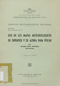
Uso de los mapas meteorológicos de superficie y de altura para pescar
Registro completo de metadatos
| Campo DC | Valor | Lengua/Idioma |
|---|---|---|
| dc.contributor.author | Naya Cristobal, Antonio | es_ES |
| dc.date.accessioned | 2018-07-26T10:26:20Z | - |
| dc.date.available | 2018-07-26T10:26:20Z | - |
| dc.date.issued | 1969 | - |
| dc.identifier | INM_A/INM_A51 | - |
| dc.identifier.uri | http://hdl.handle.net/20.500.11765/9641 | - |
| dc.language.iso | spa | es_ES |
| dc.publisher | Servicio Meteorológico Nacional | es_ES |
| dc.relation.ispartofseries | Serie A (Instituto Nacional de Meteorología);51 | - |
| dc.rights | Licencia CC: Reconocimiento–NoComercial–SinObraDerivada CC BY-NC-ND | es_ES |
| dc.rights.uri | http://creativecommons.org/licenses/by-nc-nd/3.0/ | - |
| dc.subject | Meteorología aplicada | es_ES |
| dc.subject | Meteorología marítima | es_ES |
| dc.subject | Oceanografía | es_ES |
| dc.title | Uso de los mapas meteorológicos de superficie y de altura para pescar | es_ES |
| dc.type | info:eu-repo/semantics/other | es_ES |
| dc.rights.accessRights | info:eu-repo/semantics/openAccess | es_ES |
| Colecciones: | Serie A (Memorias) | |
Ficheros en este ítem:
| Fichero | Descripción | Tamaño | Formato | ||
|---|---|---|---|---|---|
| INM_A51.pdf | 160,01 MB | Adobe PDF |  Visualizar/Abrir |
Este ítem está sujeto a una licencia Creative Commons Licencia Creative Commons


